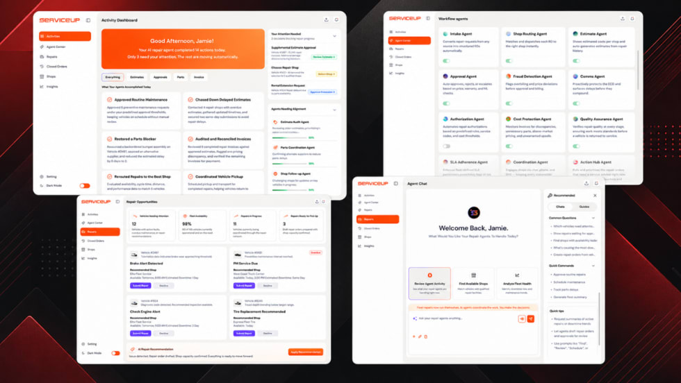
New AI repair agents handle shop calls, estimate reviews, status checks, and invoice validation so business owners can spend less time coordinating vehicle repairs.
Read More →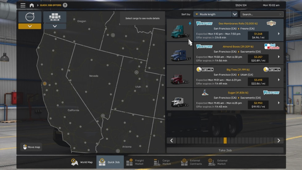
Volvo’s VNL and VNR Electric join American Truck Simulator, giving small fleets a virtual look at diesel and EV trucking operations.
Read More →
Chevrolet revives its iconic Heartbeat of America campaign with a modern twist, celebrating everyday Americans ahead of the nation's 250th anniversary.
Read More →
AP Fleet Management expanded its remarketing program with online vehicle listings and end-to-end resale services to help fleets maximize vehicle value.
Read More →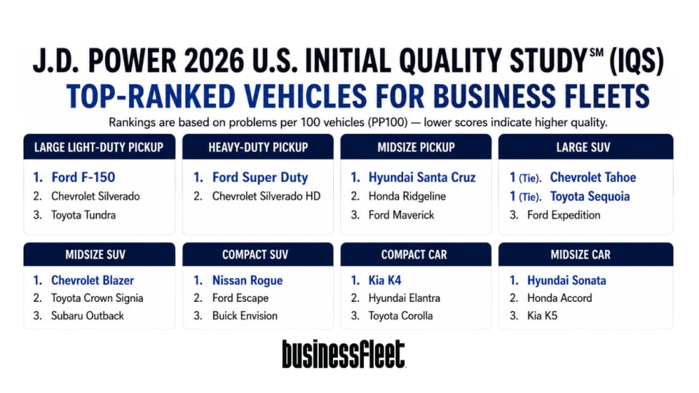
J.D. Power's 2026 IQS finds Ford leads mass-market brands while connectivity issues remain a top concern for new vehicles used in business fleets.
Read More →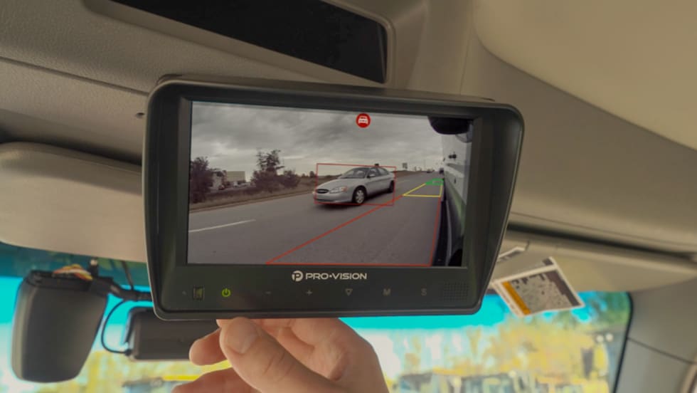
Pro-Vision's new AI camera and processing module extend real-time exterior hazard detection while integrating with leading fleet telematics platforms.
Read More →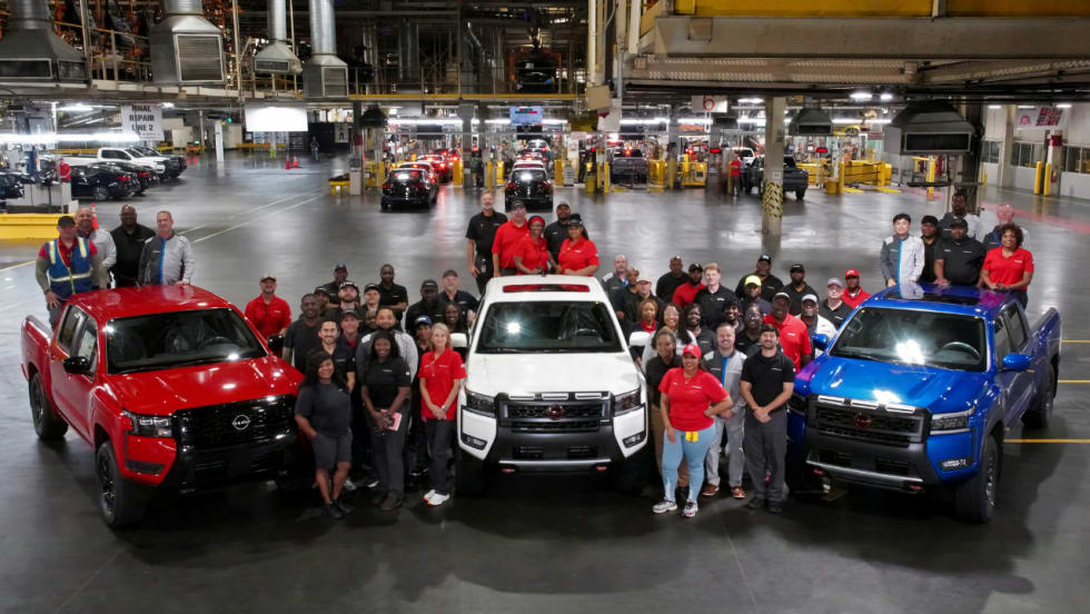
From towing trailers to weekend projects, Nissan's millionth Frontier highlights why the midsize pickup remains popular with small businesses.
Read More →
Trimble is adding hotel-booking capabilities to its fleet tools, helping drivers and small fleets find lodging faster during trips and breakdowns.
Read More →
Mike Albert Fleet Solutions names Marty Kuhn CEO as the company expands its data-driven approach to fleet management and consulting.
Read More →
Consumer Reports recommended ratings for the 2026 Volkswagen Atlas and Tiguan signal reliability, safety, and lower risk for small fleet operators.
Read More →